Wednesday, September 12, 2012

I'm no Angel


Mount of the Holy Cross

14,005’
September 8th – 9th, 2012
 54/54/24
 
I may not be an angel, but I did earn my halo this trip! I have heard more than once that the Holy Cross Wilderness area is Colorado’s Bermuda Triangle. Several people have gone in for a hike or to climb its peaks never to reappear. Just a spring the body of a man from Chicago was found after going missing in 2010.

With this knowledge I was a little worried about heading up to tackle Holy Cross. My fears were somewhat alleviated by the fact that Doug would be joining me, on this my last plan 14er of the year. Our plan was to do the Halo Ridge Orbital route which goes up to Notch Mountain, across Halo Ridge to the summit, then back to the car via the standard Northridge route.   The highlight of this route was going to be able to spend the night at the Notch Mountain shelter at 13,000’.
 
When he arrived at the trailhead most of the parking spaces were filled. Doug had to wedge the 4Runner into small pull off just before the entrance to the campground. We tried to pack in as light as possible since we would have to carry everything with us up and over the summit. The shelter eliminated the need for tents or bivies and the stop at Subway in Vail took care of the need for cooking gear.
 
We headed up the Fall Creek Trail light on water with plans to fill up in about 3 miles. With only about 5 miles to cover to reach a shelter we set an easy pace towards the shelter. With plenty daylight left there was no need to rush; better to save our legs for the long day tomorrow.   The trail was well-defined and easy-to-follow. The elevation gain never too steep for too long.
 
After two and half miles we left the Fall Creek Trail and headed up to North  Mountain Trail. Just before  leaving tree line we found a small tickle of a stream and filled up on water. This was our last chance to get water until after we had descendent of the summit and reached East Cross Creek tomorrow.  I could feel the extra 6 pounds of water on my back as we took off  again and climbed through  the many switchbacks leading to Notch Mountain Ridge.  There has been much made about these switchbacks (30 plus in all) on all the 14ers.com trip reports.  Many of these reports have made the switchbacks seem like a trudge.  I found them to be pretty good and made the climb up to the ridge much less strenuous. Than a direct attack.
 
Once we reached the ridge I was surprised that the hut was only a short 200- 300 hundred yards to the south. I thought we're going to have to traverse on the ridge little ways longer before we would reach it. As we investigated the shelter we found we had the place to ourselves which surprised us.  We both thought the place might be crowded with other climbers. The inside of the shelter was very clean; only a few candles stubs remained as signs of previous visitors. I would have liked to see the shelter have a register, but none was to be found.  Perhaps I will have to come back up here sometime bring one.
 

As the sun began to fall below the horizon behind Holy Cross Mountain, an incredible, soft, warm light fell over the ridge and the hut. On a rock, a little ways in front of the shelter, was a plaque honoring William H. Jackson, who took the first picture of Mount of the Holy Cross in 1873.  This single iconic image served as the inspiration for all the pilgrims who would follow and travel here to gaze upon it.  In fact, it was for these pilgrims that the shelter was built.
 
The last rays of light found Doug and I tucked into our bags inside the shelter . Just After Dark we heard voices approaching the shelter I called out and invited them to join us.  (in the mountains there is always room at the inn). They were a couple from Denver and I was amazed by the weight the guy carried in: 6 L of water and 2 - 40 ounce BOTTLES(???) of Budweiser for starters. I think they were expecting a bit of a party attitude at the shelter; instead they found us two old guys.
 
Throughout the night I found myself waking and breathing deeply. I'm not sure what the actual cause was of this was: the fact that we were sleeping at 13,000” (my highest night sleep ever) or just the thought that I was sleeping up high that had me gasping for breath.  Either reason I ended up having a restless night’s sleep.
 

The morning light was as beautiful and gentle as the previous night's.  We actually slept in a little later than most 14ers as we did not want to start traversing Halo Ridge in the dark.  From the shelter the Halo Ridge route stretched 2 miles, and summated three 13ers on the way to Holy Cross’s summit. Most reports I read said it takes 3 - 4 hours to complete.  We were hoping for less, but I was mentally prepared longer.
 
The ridge is a beautiful line; knife-edge looking when viewed from the north, with long, steep, vertical drop-offs.   The south side of the ridge reveals it's gentler, but  talus covered side. We summited the first 13er quickly without much effort, shortly after leaving the shelter. To reach the base of the second 13er, the crux of the route, we  had to continue the traversing past two cock cliff bands, or gendarmes as they are  called. The first was passed to the south, below the top of the ridge line.  The second I took much closer to the ridge, which is a little more adventuresome with the steep drop off just a few step to my right.
 
Doug and I each chose our own path up the second 13er as we each picked our  way through the blocky talus.  Having to stop frequently and choose the way through the next section provided a nice break to my lungs and made the climb not overly strenuous. We made summit number two in about 40 minutes. From here we had a great view of where we had come from and where were going. A short section below the summit brought us to the 6 foot bottlenecked on the ridge. 
 
The north side of the bottleneck fell away sharply to the basin far below; the south side not so much.  Once past the bottleneck the ridge flattened out for little over a quarter-mile before reaching the base of third 13er.  As I followed the ridgeline towards the summit, I had to work past three false summits before finally reaching the true summit. I think you could actually bypass the first two false summits by continuing to traverse further west on the lower flat section of the ridge, then ascended steeper gully, which looked to lead directly up to the third false summit.  The third summit was a heartbreaker. I would've sworn, as I approached it that it was the real deal; nice and blocky almost turret like.  However the true summit was only another 50 yards or so away.
 
Approaching the true summit the ridge makes a sharp 90° turn to the below you just disappears beneath your feet. To the west the views open wide to the ranges further in the back of beyond.  The descent off Point13,831' was slow.  Once again we had to pick our way down, through and over more blocky talus.  So far we had not seen any sign of the dreaded mountain spiders that are told to inhabit this area.
 
This traverse over to the final climb up to Holy Cross’s summit crossed over the head of several couloirs that look like they would be great snow climbs.  Maybe someday!  The final 500 feet of elevation gain was once again on the now familiar blocky talus that we had been encountering all morning.
 
We reach the summit of just after 11 a.m., four hours and 15 minutes after setting off the shelter this morning. There were three other parties on the summit when we arrived, and three more quickly joined us All of the other groups had come up the standard route.  After 20 so minutes on the summit we began the descent off the Northridge with two other parties. The Northridge was slow going and much longer than I had envisioned. The trail was in good shape and had signs of still being in the process of being worked on.  Based on the current trail conditions I do not see how anyone could get lost.  I think it would've been a real endurance struggle to make it up this ridge originally.
 
Our pace quicken once we're back on the dirt trail below tree line. We continued to moving until we reached East Cross Creek where we rested and filtered another liter of water, for the rest of the hike out. We talk to you guys had taken our same route but had started at the trailhead at 6 a.m. Damn they are moving fast!
 
From the creek we had a 1000 foot climb back up to Half Moon Pass. Many complaints have been made of this ascent, but once again I did not find it to be too bad. The steepest section was over within 20 minutes. The descent off the pass to t he trailhead was the quickest of  the day.  We passed several parties heading up during the last 3/4 mile from the trailhead.

The Sawatch Range is finished and I completed my 14ers goals for the year. This was the best trip the year by far, and probably of all my 14ers. It was a great route with fun challenges and immeasurable rewards. What a way to end the season! At least as far as I have planned anyways. See you next season.


Check outt he complete trip photos HERE


Wednesday, August 15, 2012

An Ivy League Education


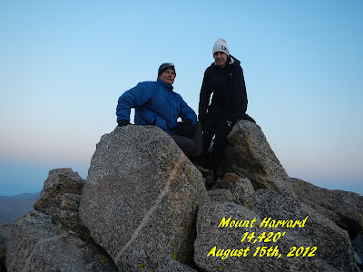
Mount Harvard & Mount Columbia
14,420 '     -         14,073'
August 15th, 2012

54/54/22-23


"Once more into the breach, dear friends, once more."  I never thought I would make it into an Ivy League school, let alone graduate from two in the same day.  I must be pretty smart after all!  Well maybe not that smart (or bright?) as I keep chasing after these peaks.  I was hoping to make this trip my last outing down to the Arkansas Valley to climb 14ers.  It is a beautiful area, but I have grown weary of the 3.5 hour drive each way.  With Doug gone climbing Mount Rainer, and Jon not up to the challenge of these two peaks in a day this year, I had to search out a new partner for this outing, as I was informed that I was not allowed to go solo on this one.  Through a series of circumstances I found Dave B, the son of one of my co-workers.  Young and full of energy I worried about being able to keep up with him, even though he had only done 5 14ers previously.

We left Fort Collins, late morning on Tuesday and made it down to the trail head in just under 4 hours, including a stop at Subway so we could pack in dinner rather than worry about carrying a stove and cookware.  We started from the North Cottonwood trailhead at the end of CR 365.  We followed the trail for about 3 miles into Horn Fork Basin where we established camp about 300 yards past the trail coming down from Mount Columbia.  The trail into the basin was in great shape and mostly smooth.  I pushed my usual pace on the way in, as I did not want Dave to think he had be saddle with an old , slow man for a partner.  Better he wait until the second day to find that out.  For the most part the approach trail followed a repeating pattern of climb, flat, climb, flat.  The uphill climbs were never too steep or too long, but still I welcomed the flats sections.  The last 3/4 of a mile or so became studded with baby-head sized rocks once again, slowing my pace down some.  We made the 3 miles to camp in just about 2 hours.  There were 3 or 4 other parties that we saw camped in the basin near us, but we were able to find a private spot for our tent, tucked into a small opening surrounded by trees, just in from of the large rock out cropping that can be seen while coming down from Columbia.

A steady rain began about 3 p.m. and kept us tent bound for an hour, during which I managed to sneak in a little nap, while Dave read.  Subway turned out to be a great choice for dinner; tasty and easy to prepare. With the alarm set for 3:30 a.m. we called it a night early.  Not sure how much sleep I actually got.  It felt like I tossed and turned all night long.  I could feel the temperature drop once the sky cleared, which was good news for our climb in the morning.  I remember looking out the tent window once the alarm sounded to be greeted by a sky full of stars.

We put feet to the trail at ten minutes to four.  Temperatures must have been in the mid 40's as we began out ascent; perfect for hiking.  The first mile of the trail continued working its way up the basin without gaining any significant  elevation.  Even in the dark it was easy to follow.  At the turn off for Bear Lake the trail took on a new personality.   The smooth path gave way to talus, and began to climb.  Several times we had to search for the correct path.  As the night gave away to the gray of dawn I could see Harvard's summit much closer than I imagined.  Dave past me on the way up to the saddle below the final push to the summit, as I was starting to feel the elevation.

The final push  was a lot of fun as we had to work our way over some large boulders to gain the actual summit.  I reached the summit at 6:10 a.m.  I was surprised at how quickly we made the summit.  I had estimated that it would take at least 3 hours, so I was really happy to be ahead of schedule.


I had been very conscious about eating on the way up.   I did not want to have a repeat of my bonking on Shavano and Tabeguache.  I was eating two shot blocks every 30 minutes, which seemed to be doing the trick to keeping me going.  I had a Ritz cheese and cracker packet once on the summit, to try to put some "real" food into me.  After the usual summit pics we began working our way towards Mount Columbia.

The traverse between Harvard and Columbia is about two miles.  Most of the reports that I read said it took people between four to five hours to complete. I'm not that slow am I?  From Harvard's summit we headed eastward along a rocky ridge.  There was no one correct path so we just picked the one that seemed to work for us.  Shortly after we crossed from the south side to the north side of the ridge we passed within four feet of a marmot sunning itself in the early morning light.  He did not seemed to be alarmed by us, and posed for several pictures.
 
Having studied the traverse pictures from 14ers.com, it felt as if I had been here before as we passed each of the landmarks.  My only surprise was the obstacles were much easier than they had looked from the pictures at home.  Just before the ridge turns sharply southward, we began to look for a way down to the easier lower ground.

Once the ridge turns south it becomes very narrow and steep (cliff-like) on both sides; looked like class III and IV climbing.  I mentioned to Dave that we wanted to drop down before we reached a loose gully. Before dropping down I was forced to stop and relieve myself, but told Dave to go on and I would catch up. By the time I caught up with him, he was already headed down the lose gully I told him we wanted to avoid.  Looking back now, there was a distinct ridge line  marking the start of this gully that we should have picked up on.

We quickly found out why 14ers.com said to avoid this gully.  Everything was really lose.  Each step held the potential for sending rocks tumbling down the gully.  I had to make sure that I was not moving directly above Dave at any time.  At one point a section of rocks that I had just crossed over, slid, sending several hundred pounds of lose rock avalanching downward.  Luckily the mass of rocks only slid about 30 - 40 feet, before coming to rest.  If you do find yourself in this gully the best route is probably along the left-hand edge (as you are heading down), near the walls, as the rock to seemed more solid there.

From the bottom of this gully, we headed southward and started my favorite section of the entire climb.  Dave and I separated as we both worked our way through the large boulder field towards a sloping ramp leading up to a flat section.  We were out of site of each other through most of this section as we each picked our way through the huge boulder.  It was like working your way through a maze of rocks, trying not to get stuck on top of one of the larger ones, with no way off.  At one point I had a washer-sized boulder roll under me just as I was stepping off onto another larger one.  Nothing like a little adrenaline rush to keep me going.  As I reached the bottom of the ramp leading upward I could see Dave already  heading towards the second flat section above us.

Upon reaching the second flat section I could see two summits and no sign of Dave.  I had to pull out my pictures to see which one was Columbia.  To my surprise once again, it was the closer one, though from this location it did not look as tall as the farther summit (Point 13,298).  As I made my way to the saddle between Harvard's ridge and Columbia's summit I was feeling beat.  I was back into picking a goal 20 yards away and trying to get to it before I took a rest.  This made for slow going.  During one breather I caught a glimpse of what I thought was Dave, on his way to the summit.  He had chosen that right summit.  Once I reached the saddle it took me 40 minutes to gain Columbia's summit.  On the way up I passed a group of four, from Fort Collins, heading down and doing our route in reverse.  I did not envy them having to make the long climb back up to Harvard's summit.

I reached Columbia's summit at 10 :40 a.m.  I was happy to see Dave waiting for me on the summit after being out of contact with him for almost an hour.  There were four groups, including us on the summit.  I talked to one guy who actually traversed the entire ridge, while his partner had dropped down like we did.  He said it was faster, but sketchy in places.  The weather was still holding, but there were a few fluffy clouds beginning to build that I wanted to keep my eyes on. 


We dropped down off of Columbia's south ridge, towards Horn Fork Basin, too early on a false trail and ended up having to re-ascend about 250 feet of elevation to regain the correct trail. Once back on the ridge we followed two of the other parties along the ridge to the correct trail leading down.  Ever since Doug told me about his trip to these two peaks last year, I have been dreading the climb down from Columbia.  He described it as a lose, sliding, descent from hell.  So you can imagine my excitement as I started down.  I had built up so much  trepidation of this descent in my mind over the past year that I was disappointed by what actually awaited me.  While I found the descent to be lose, there was enough of the lose rocks that I actually sank in a little with each step getting traction, rather than skidding my way down over them.  I did not set any speed records on the way down, but I never hated it.  There was only one, 200 yard section, close to the bottom, that was really lose, that I slide down with each step.

I arrived back to camp at 12:45.  I was happy with the nine hour round trip time, and more importantly that we have missed any storms.  Once again, an early start paid off.  After packing up camp, we made the three mile hike back to the vehicle in just over two hours.

I am done with the Collegiate Peaks, and only one more left in the Sawatch Range.  One goal reached this year, one more to go. 


Monday, July 23, 2012

Blackjack!


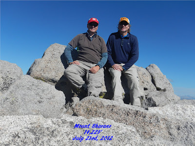
Mount Shavano & Mount Tabeguache

14, 229'  &  14,155'

July 23rd, 2012

54/54/20-21


Winner, winner, chicken dinner!  Blackjack!  As easy as that right?  I wish number 21 would have been that easy.  But the hard fought victory is all the sweeter correct?  Once more down to the Arkansas Valley.   I will be happy to finish off the Sawatch Range, and get to head to another part o the state for a while.  While the views are awe inspiring,  I am just getting tired of the drive.  
 
Doug joined me on this outing.  Even though he did it last year, he thought it would be a good training hike for his upcoming trip up Mount Rainer.  We bivied the night before just below the trailhead.  Luckily I put my tarp up, as I was woken in the middle of the night by rain falling on it.  Not too hard, but steady. 
 
With headlamps on we headed out at 4:40 a.m. The clouds from the night before, were gone, and the moonless sky was alive with stars.  The seven-sisters watched our backs as we headed up the trail.  The first quarter mile of the hike follows along the Colorado trail, before branching off to the west towards Shavano' summit.  From this point the trail climbed steadily upwards, on "baby-head" (yep.. just the size you are thinking they are)  rocks for a mile.  Once again the darkness and the limited beam of the headlamp created an isolated hiking experience.  With the trail view limited to the fifteen feet in front of me, the true steepness of the trail failed to register in my mind, though the effort was felt by my body.  From the get-go I had been feeling off.  I am never quick on 14ers, but today I felt even slower.  This sluggishness lasted throughout the day, and would take me to the edge of bonking on the way down.
 
After the baby-heads. the trail smoothed out, and passes through the blow down section.  Apparently there were fierce windstorms this past winter, which blew down a significant number of trees, both conifers and Aspens.  In the dark and from the trail all we could see was where stumps where the Forest Service had cleared the trail.  It was not until coming down, later in the day, that we saw the full force of the winter storms.  My hats is off to those who preserved and worked their way through the blow downs, and continued to the summit, before the forest service did their great work.  I know I would not of had the fortitude to push through.
 
Once you break through tree line the trail moves westward, traversing the hillside above the Angel of Shavano.  With the light snow this year, the Angel was now all rock.  Doug and I both agreed that it looked like the Angel would be a great snow route.  The trail gains the saddle below Mt Shavano at 13,380'.  The saddle gave a quick respite as we turned northward for a quarter mile, before climbing again and gaining the final 900 or so feet of elevation to Shavano's summit.  Just before reaching the summit, we were past by another party of two.  I was feeling pretty beat at this point so I did not put on the afterburners to try and beat them up.  One step at a time was all I could manage.


Worried about the possibility of afternoon storms (the weather report called for a 69%  chance of afternoon thunderstorms) we only took a quick break on the summit before heading onward to Mount Tabeguache.  I should have used this break time better, and refueled, but I did not.  I was to pay the price of this later, as I ran out of energy and my stomach turned on me.  We reached the summit at  9:10 a.m.; five hours 20 minutes after leaving the trailhead.
 
The descent off Shavano's summit was not as steep as I had imagined.  The first section involved some boulder hoping to move along the ridge before descending 600 feet to the saddle between the two peaks.  We started off the summit with the other two climbers, but they quickly left us in their wake.  By the time we reached the saddle they were more than half way up to Tabeguache's summit.  Way to move guys!  From the saddle  Doug lead the way switching between one faint trail to another.  Once again the ascent was not as bad as it looked.  We made it up to the summit. in just under 30 minutes from the saddle, and one hour from Shavano's summit.  After a few quick pictures and a brief break (no food for me once again), we were on our way back down again, as we still had to reascend Shavano to get back to the trailhead (does this count as three 14ers for the day?).  Descending off the summit we made the saddle quickly, and I was actually feeling pretty good.


That good feeling did not last!  As soon as we began to reclimb Shavano my body slowed, and doubt crept into my mind.  It took all I had to keep moving 20 yards at a time.  Which each step I could feel my stomach cringing.  I know that if there would have been anything in it, it would not have stayed down.  While resting at one point, I looked northward to Mount Antero and could see the clouds already building and darkening over it.  Shavano's summit was still cloud free, but we could see them building to the south.  Not wanting to get caught in a storm I moved as quickly as my tired body would allow.  We barely stopped at the summit, before heading down to the southern saddle.
 
Looking north to Mt Antero
Looking south to Mt Shavano Summit (taken at same time as above)

I lead the way off the saddle back towards tree line. It took a great effort to keep pushing on.  All that was going through my mind was to keep going so we did not get caught above the trees in a storm.  I knew that as soon as we were back beneath the real trees we could relax and take a good break.   Once I felt out of the danger zone, we took a 15 minute break.  I laid back on the ground and tried to get myself back under control. I managed to eat a little bite of peanut butter crackers that Doug had given me the night before.  It helped and I started to feel a little more human.  I continued to take small bites on the cracker as we moved downward to the trailhead.  By the time we reached the trailhead at 2:40ish, I was feeling back to normal;  just tired legs.  We had managed to outrun the storm and avoid all  but a few sprinkles of rain.  Once back on the main roads the  storm let loose and we were treated to a great light show almost all the way back to Denver.
 
Two more peaks into the record books for me.  Lesson learned on these two:  Eat!, Eat! and Eat some more.  I will have to try to find some better breakfast food for me to start the day off right. I have never been a big breakfast eater, but on 14er days I better learn to be.


Postscript:  I found out from my wife that Doug had called his wife from the summit of Shavano and had her schedule a doctor's appointment for the next day to have his ribs looked at.  He had a mountain bike crash a few days earlier, and was apparently feeling it in his ribs today, though he never let on.  X-rays showed a cracked rib.  Makes me wonder what the heck I was whining about, with my tiredness and stomach.  These old guys can be tough!!  A few (well more than a few) years and I will be there.


Monday, July 2, 2012

Mt Antero


Mount Antero

14,269'
July 2nd, 2012

54/54/19


Sometimes you just have to pinch your nose and swallow your medicine.  In my quest to climb all 54 ranked 14ers in Colorado, Mount Antero seemed like it was going to be one of these times.  A ten mile round trip with over eight miles of it being on a well used 4WD road, did not sound like my idea of an ideal wilderness outing.  But remember, "a spoonful of sugar helps the medicine go down."  A last minute call to J.C. and I had a partner for this trip.  It would be his first 14er of the year. 

So once more this year I was headed back down into the Arkansas Valley.  Karen and I should have attempted this peak when we were down here two weeks ago, as the trailhead was only 10 miles or so past Mount Princeton Hot Springs.  We left Fort Collins at 4 p.m. with the hope of being able to get up the first 3 miles of the 4WD road, up to Antero, and over the creek crossing to set up camp before dusk.  We started up the road at 8 p.m. and made it into our camp just before dark.    This is the toughest 4WD road that I have driven on.  While it was wider than the road up to the radio towers at Mt. Princeton, is was much more rutted and rock studded.  I had a firm grip on the steering wheel of the X-terra as we slowly climbed up to 10,840'.  It was a relief to finally reach camp and turn in for the night.
 
With the weatherman calling for a 40% chance of thunderstorms after noon, we hit the trail at 5:45 a.m.  Trail is a misnomer, as four of the five miles up this route are on a well used 4WD road.  The road climbed a little steeper than I had imagined, but we managed to keep up a steady, but slow pace.  I was feeling sluggish this morning for some reason.  I did not seem to get my usual hiking legs, after warming up.

After climbing southwards for a mile and a half or so, the road begins a series of switchbacks leading up to Antero's south ridge.  Just past the first switchback I spied an obvious rocky wash, leading upwards to a steep grassy slope, which topped out a couple of hundred yards below the south ridge on the 4WD road.  It looked like this route would go and avoid most of the switchbacks.  I would like to say I by-passed this option because I wanted to get the entire Antero experience, but truth be told, while this route looked do-able, it also looked steep, and frankly more work than I wanted to put in this early in the day.  Jon and I continued to hike up the road and eventually gained Antero's south ridge at 13,089'.    A half mile below the ridge we were passed by an older Ford Bronco on its way down.  The driver was amazed by the fact that we had hiked up from the stream.  I was amazed  that he drove up.  While the road  was better than the first three miles we drove up, I do not think my nerves would have held up for me to drive all the way up here.  On the ridge is a sign talking about the history and gems of the area.  I noticed a patch of what looked like mountain goat hair imbedded in the wood of the sign, with a larger clump on the ground below.  It looked like a goat had used the sign as an itching post to help shed its winter coat.

We continued moving eastward on FR 278A.  To the south we had a great view of Mount White.  There was an SUV parked on the ridge below White's summit, which looked really cool in silhouette.  After a half mile or so the road once again began to switchback towards the road's end.  I ended up cutting the last switchback and headed cross country to reach the end of the road, where I was greeted by a mamma mountain goat and her kid.  I sat on a rock and waited for Jon within 20 yards of them. The kid was a little jumpy but mom seemed relaxed.  Just before Jon joined me, five minutes later, the pair had ambled out of sight.  What a treat for me!

Where the road ends, the fun begins.  The remainder of the route to the summit can be broken down in two sections: the ridge, and the rocky summit push.  The ridge consists of a class II scramble.  Nothing difficult, but enough variety to make this section fun and interesting.  Great views could be seen below each side of the ridge to the east and west.  The final summit push was through a boulder field.  There were two options for this push, a direct ascent to the summit or a traverse eastwards then a final switchback to the summit.  Once again I went with the more gentler option.  I reached the summit a few minutes before Jon, an enjoyed the solitude.  The weather was perfect; blue sky, no significant clouds, and no wind.  We relaxed and fueled up for 30 minutes, with no other company, before heading down.

Half way back across the ridge we noticed that the sky was beginning to darken.  The clouds seemed to appear out of nowhere.  We made it off the ridge and 100 yards down the road before the thunder began.  Shortly after the thunder, lightening streaked horizontally across the sky just to the west of us.  I did not need any more encouragement to pick up the pace.  I have only been caught above tree line in a lightning storm once before, but once was enough for me to know it was not a place I wanted to be.  As the road curved back onto the south ridge, Jon and I both put on our rain jackets.  Within 5 minutes the rain had turned to a hail/sleet mix.  We were passed by several vehicles that decided it was time to head down as well.  When we turned north off the south ridge we walked into the full force of the storm.  With the sky still dark and thunder rolling on I decided I needed to get down as quick as possible.

After a quick consultation with Jon, I headed down the steep grassy slope that I had first noticed on the way up.  While it was steep, the ground was solid and I made quick work on the descent.  I kept looking back to make sure that Jon was doing good as well.  The lower we got the better the storm got.

The bottom of the grassy slope gave way to the rocky gully.  Both Jon and I kept our eyes peeled for crystals as we worked down the gully.  No luck though.  The gully deposited us back on the road, at tree line.  It was great to be back below the trees again.  With a big sigh we started down the road towards the car again.  We made it back to the car by 1:30.  As happy as I was to avoid getting zapped in the storm, we still had the drive out to contend with.  I was worried that the rain would have made the road slippery, making for an interesting ride out.  turned out that it was a needless worry.  The road was in as "good" of shape as when we came up.  When we made it to the main road, there was no sign that the rain had made it that far.

Antero is not my first choice for a 14er to do again.  It would be a good first 14er to take someone on, if you drove all the way up to tree line, to avoid much of the road walk.  They would not get the '"required" 3000' elevation gain to "officially" count, but it would be a nice intro to 14ers. 

3000' elevation gain, is as Roach says, the "Purists" goal on each 14er.  Is this something I need to stick to? Does is matter if I do not gain 3000' on each attempt?  After all this is my own project, can't I set my own rules?  If I do start setting my own rules, where do they end?  Couldn't I just drive up Pikes Peak and call it good?  It may be my project, but it is their game, so I have decided that I need to play by their rules as best as I can.  I do not feel that I have to gain 3000' on every 14er separately, but rather on each outing ( for example the Lincoln, Democrat, Bross group).  Hopefully this is enough to gain the respect if the 14er community, once (if) I complete  all 54.  Respect is not why I am climbing these mountains (that is a whole separate entry someday, once I figure it out myself), but I would like to think that others would say I played the game honestly.


Wednesday, June 20, 2012

Mount Princeton


Mount Princeton
14,197'
June 20th, 2012

54/54/18

After a day off to recover from our meeting with the queen of Colorado 14ers, we decided to go see if we could meet up with the Prince.  While lounging and resting at Mount Princeton Hot Spring's pools the day before, we were able to stare up at our objective of the day, Mount Princeton, 14,197'.  The springs had done their job and relaxed Karen's knees and legs, from the Mt Massive hike, so she agreed to give it a shot.

With the X-terra doing a great job getting us to the upper Mt Massive trailhead, I decided to give it another go and drove up to the radio towers on Mt Princeton.  This also would take six miles off of our roundtrip distance.  The drive up to the radio towers was an adventure in itself.  The road is not wide at all!  I think it was about 5-6 feet wider than our car; less if you ask Karen.  She was white knuckled the entire drive up to the towers.  I think there are still fingernail marks in the dashboard.  While the road was narrow it was in good shape and relatively smooth.  Luckily we did not encounter any other vehicles coming down the road as we were going up.  I am not sure how we would have managed to pass each other, as there was only one or two good spots to pull over to let each other pass.

We headed upwards right around 7 a.m.  From the radio towers the trail climbs the road up through several sets of long switchbacks to 11,800'.  The road made for a nice warm-up, which let us work out the last our aches.  We had a black FJ pass us on the road as we worked our way up.  They said they had spent the night in the Chalet  near the top of Point 13,971, and left for the summit at 4:30 a.m.  I did not know that there was any type of shelter up there, might be worth looking into if we ever return.

The turn off the road to the trail was not as well  marked as  I thought it would be.  It looked like the cairn had fallen over and the stone steps broken down.  Must have been a rough winter up here, or we headed up the wrong trail.  And of course with the low snow year the second choice was the correct one.  We left the road about 30 yards to early, but did not fully realize this until we came down later in the day.  The correct turn off is every well marked, with a great cairn and steps.  So if the trail does not looked well maintained keep going up the road a little until you see the correct turn off.
Keep going. This is not the correct turn off!

Once off the road the trail climbs to a small ridge, before turning west and entering the rocks. The trail traverses westward below Point 13,300 through a continuous talus field.  The trail was much easier to follow than on Massive.  About a third of the way through the traverse, Karen decided she had enough.  She just got to a point where she did not feel comfortable.  Looking back now, I wish I would have stayed with her a little longer because I think I would have been able to help her get passed the section that was scaring her (it was not scary, just a loose section of dirt/scree mix).  As Karen turned back towards the ridge I continued on.

The trail through this section never felt steep.  The rocky terrain kept it interesting as I had to watch my footing.  I think I got off trail a few times, as I found myself moving up, down and over large boulders, that I did not notice on the way back later in the day.  The trail finally began to climb once it hit the "new" rerouted section up to the ridge between Point 13,300 and Princeton.  The wind, which had been minimal up to this point, was blowing good over the saddle .  Strong enough that I had to stow my hat to keep from losing it.

I broke the climb up to the summit from this point  into 3 sections: cliff band, bump, summit.  I have always found that smaller goals, make the overall progress go much quicker on 14ers.  I managed to lose the main trail on the way up to the cliffs and ended up climbing farther to the east than the actual trail.  Before I knew it I was standing just above the cliffs, looking upwards to the "bump".  I ended up combining sections two and three into one push. 


About half way up, off route again, I came to a plaque memorializing a women who had been killed by lightening on that very spot in 1995.  It was a humbling reminder of the risk we take when we enter the high country to play our games.  I carried her memory up to the summit with me and hoped she was watching out for me on this day.


I reached the summit at 10:14; my usual 1000 feet per hour pace still in tack.  Once again I found myself alone on a peak.  It has been so nice to be able to experience the summits this year with no crowds, and almost no other people around.  Shortly after arriving the winds picked up.   At one point I was able to lean into them and stay standing up right.  The wind actually knocked over my camcorder and tripod.  I ate a quick bite and headed down, because I did not want Karen to have to wait too long for me.


Heading to the western edge of the summit for one last picture, I noticed a large group coming up from a different route than I had ascended (probably from the grouse Creek trailhead).  I tried to get off quicker now, so that they could have the same solitary summit experience that I had.  I passed a lady and her dog (Aussie) on my way down before hitting the ridge again.  She had started from the lower trailhead, just as we drove through this morning.  She was making good time!  I also passed a group of three "older" gentlemen just before dropping off the ridge again.  They asked, with a smile, if they were "on the right path to Mount Yale?"

The hike back to the ridge above the road went without a hitch.  I actually managed to stay on the correct trail the entire way.  I was surprised to arrive back at the lower ridge and see Karen still there.  I had told her to head back to the car and I would meet her there.  Apparently she decided to hike further up the ridge and investigate the Chalet and surrounding area.  It was nice to be able to walk the remainder of the way back to the car with her.  We made it back by 2:30; just over six hours for the round trip. 

Once back to the car, we still had the three miles down the 4WD road to contend with.  White- knuckled and slowly we made our way back down (more of Karen's nail marks in the dashboard) to the main road.  We made a quick stop back at the hot springs to wash off the dust, and try out the water slide that we missed the day before, before we headed home.

I felt really good the entire day.  I should have eaten better, as I only had one pack of cliff blocks the entire day.  I got away with one there.  This was probably the easiest 14er I have done so far, but very enjoyable. 


Monday, June 18, 2012

Mt Massive


Mt. Massive

14,421'
June 28th, 2012
54/54/17


Doubt -to be uncertain about; consider questionable or unlikely; hesitate to believe.


"If doubt is challenging you and you do not act, doubts will grow. Challenge the doubts with action and you will grow. Doubt and action are incompatible."

~ John Kanary ~


"If you doubt you can accomplish something, then you can't accomplish it. You have to have confidence in your ability, and then be tough enough to follow through."

~ Rosalyn Carter ~


Rising from the Arkansas Valley, Mt Massive is only exceeded in height by its neighbor to the south, Mt Elbert.  If Elbert is the king of the Rockies, then Massive must surely be its queen.  With my parents in town for a week, Karen and I were able to escape together for a few days to ourselves.  We set our sights on hiking two 14ers with rest day at Mount Princeton Hot Springs in between.  When planning for this trip I put a question out on 14ers.com on which route to take up Mt Massive:  the longer (13.5 miles) standard route, or the shorter (8 miles) but steeper S.W. Slopes.  While I got plenty of responses, I think it was the fact that I was being lazy, and did not want to hike farther than I had to, that lead us up the S.W. Slopes.  As a bonus I would get to try the X-terra on a good 4WD rode.


The road up to the North Half Moon trailhead did not turn out to be all that bad.  It was only the last half mile that I actually needed the 4WD for.   I really wanted to try the creek crossing just past the trailhead, but luckily Karen is smarter and wiser than me, and vetoed that idea.   We set up camp in the field just to the east of the trailhead, and had the place to ourselves.  We turned in early in anticipation of a 5 a.m. wake-up.


 I slept restlessly, tossing and turning throughout the night.   I think the climb was weighing on my mind.  I was not sure that I was up to the steepness of the climb.  This approach to the summit gains 3950' in four miles.  Doubt was beginning to set in. 


With the first mile being relatively flat it meant we were in store for a lot of elevation gain in a short amount of time.  The first mile and a quarter roughly parallels Half Moon Creek, which was flowing  strong for as low of a snow pack that we had this past winter. We took our time through this section, using it as a warm up.  We were passed by another couple who had left five minutes behind us.  40 minutes later I began to question if we had missed the trail turn off, when we passed two  backpackers coming down from Half Moon Lakes, who told us we were almost there.  The turn off was well signed and had a large cairn, so I doubt there was any way we could of missed it.


Once on the summit trail, the climbing began and kept up all the way to the summit.  Where the trail crossed through boulders, we had to keep a sharp eye open so we did not lose the trail, as all the rocks blended together.  Karen did a great job of keeping us on track.  While the trail did climb the entire time, it never felt too steep.  At no time did we feel like we were going to topple over from exhaustion.  However, as we climbed up doubt continued to seep into my mind.


Doubt, of if I could make it up.  Doubt, of why I was doing this.  Was my goal of completing  all 54 "official 14ers" worthwhile?  Was I enjoying this, or was I just checking another one off?  There is only one way to get rid of doubt.  And that is to keep pushing through, which is what I did.  One step at a time! 


My favorite part of the climb was the traverse to the summit after we crossed over the saddle between South Massive and Massive itself.  The east slopes of massive was laid out before our eyes.  All four of Massive's peaks above 14,000' on were laid out in front of our eyes..  As we made our way across to the summit, the couple that passed us in the morning were working their way back across it.  We ran into another couple, who quickly left, at the summit.  Once they were gone we had the summit to ourselves for 30 minutes, until we decided to head back down.

Summit


The only disappointment was that someone had left a Frisbee on the summit. While their intention was good (it was a gift for whomever found it), I looked at it as trash, which someone would have to remove (which I did). I am sure the group of "youngsters" that came up after us would have really enjoyed the find, but I could not help but thinking it as defacing the peak somehow. "Take only photographs, leave only footprints".

While prepping for this climb I had read comments about the white marmots on Massive. I began to think these were in the realm of snipe hunts. So you can imagine my surprise when Karen actually spotted one, sunning on a rock right next to another brown marmot. They do exists!! I have the picture and video to prove it.
 
The hike down was a little more challenging than we had imagined. Stepping down through the boulders, beat our knees up pretty bad, even with the use of trekking poles. We were both happy to get back down to the flats.

 Once back down to the trailhead I dropped my pack and headed to the creek to soak my feet.  The water was bone chillingly cold, but it did help sooth my tired feet.  I could not bring myself to soak any of the dust off the rest of my body.

I felt stronger on today's climb, than I did on La Plata two weeks ago.  Hopefully I will continue to gain strength of each 14er.  I love to be able to do one of these one day and say "that was easy".  Until then, I'll just keep taking it - One step at a time,